Following the passage of storms Eowyn, Herminia and Ivo, France is preparing for the arrival of a continental flow. " Coming from northeastern Europe ", it will bring " increasingly cold air to the country ", warns La Chaîne Météo, which adds that this " change in air masses could favor some winter precipitation in certain lowland regions ", particularly " up to very low altitudes ". This change in weather is expected to occur this weekend, on Friday February 7, 2025.
" Outside the mountains, a return from the east is also likely to bring a few snowfalls to the northern half of the country ", adds La Chaîne Météo, which points out that " flakes could make their appearance between the center-west and the Paris basin, with a risk of temporary holding on to the ground, particularly on plateaus and sparsely urbanized areas ". " The amount of snow on the ground will remain modest, however, with a maximum of a few centimetres depending on the scenarios of the various models ", the weather specialist is keen to emphasize.
For its part, Météo France also confirms a deterioration in weather conditions for this Friday, February 7, announcing the arrival of a cold drop from the east. " This could generate a few fairly light showers, but possibly snow north of the Loire, particularly in the northeast, with heavier showers over a southeastern quarter, with rain on the plains and low-level snow in the mountains ", the weather service explains.
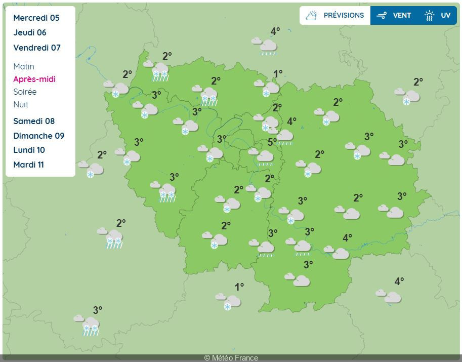
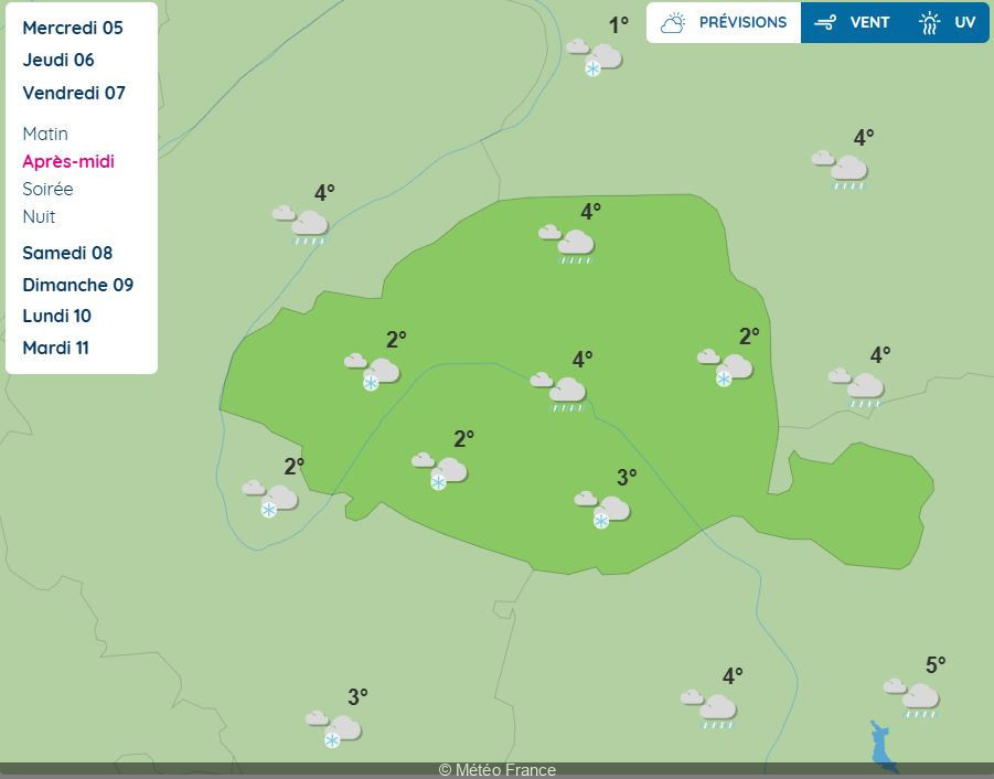
So what can we expect in Paris and the Ile-de-France region? Will snow make a comeback in the Paris region this weekend? For the time being, Météo France is forecasting possible snow showers over much of the Île-de-France region on Friday.
In the morning, a few flakes could fall locally in the Yvelines. Then, in the afternoon, Météo France announces the possible arrival of an episode of mixed snow and rain, particularly in Val-d'Oise and southern Yvelines. In the north of Seine-et-Marne and Yvelines, and more generally in Essonne, there could be a light dusting of snow.
Residents of Paris and its inner suburbs may also see a few flakes in the afternoon. In the evening, the rain will take over, except in the Yvelines department, which could still be affected by this episode of mixed snow and rain.
We remind you that, for the moment, these are only forecasts. To find out whether snow will indeed make a comeback in several Île-de-France départements this Friday, you'll need to keep a close eye on the weather. We recommend that you keep up to date with any further updates to the vigilance map. In the event of black ice and snow, we advise you to limit your movements as far as possible, particularly by car.
Official website
meteofrance.com