Will thunder rumble across Paris and the Ile-de-France region on Thursday August 29 and Friday August 30, 2024 ? Météo France is forecasting the arrival of a stormy deterioration in the south-west of the country, then in the north.
As a result, the weather service has placed many of France's départements under yellow alert for thunderstorms on August 29 and 30, 2024. These include Pyrénées-Atlantiques, Landes, Vendée, Charente-Maritime, Dordogne, Lot-et-Garonne, Marne, Cher, Vienne and Oise. " Thundershowers are arriving via the Bay of Biscay and circulating in Aquitaine, with locally heavy rainfall " warns La Chaîne Météo, , adding: " On Friday, the instability arriving from the southwest will gain ground towards the northwest and the Paris Basin, with a risk of thundershowers. "
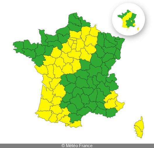
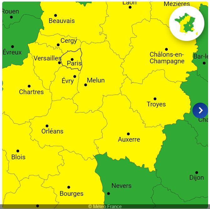
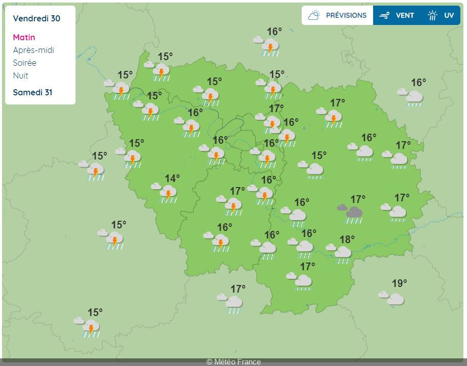
So, what's the situation in Paris and the Ile-de-France region? The 8 departments in the Paris region are affected by this warning, and have been placed on yellow alert for thunderstorms on Thursday and Friday. The situation in Paris, but also in Hauts-de-Seine, Seine-Saint-Denis, Val-de-Marne, Seine-et-Marne, Yvelines, Essonne and Val-d'Oise, will be closely monitored over the coming hours.
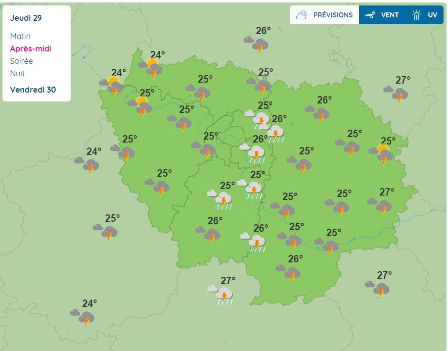
According to Météo France, this severe thunderstorm could affect the Paris region from 4pm on Thursday August 29, and continue throughout the evening and night. The yellow "thunderstorm" alert has been extended for Friday. On August 30, thundery showers could hit Paris and the Ile-de-France region all day until 6pm.
Residents and visitors to the region are therefore advised to remain vigilant, follow Météo France's updates and take the necessary precautions to protect themselves from these severe weather conditions.
During this period of bad weather, Météo France advises you to watch out for thunderstorms, which are synonymous with danger. Here are a few recommendations to follow as a precaution:
Dates and Opening Time
From August 29, 2024 to August 30, 2024
Official website
meteofrance.com