Will thunder rumble this Saturday, June 29, 2024 in Paris and the Paris region? More than likely. Further thunderstorms are likely to hit large parts of the country this weekend. For this reason, Météo France has placed a number of French departments under yellow thunderstorm alert for the day of June 29.
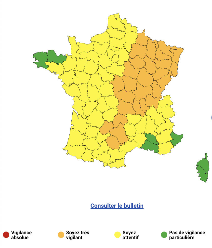
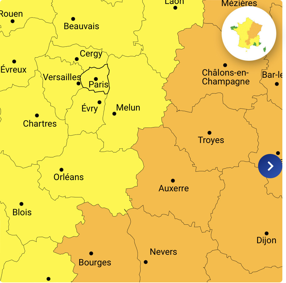
Météo-France updated its vigilance map at midday, placing 28 departments under orange vigilance for thunderstorms, while the Île-de-France region remains under yellow vigilance. The departments concerned by the orange alert include Cher, Nièvre, Yonne, Côte-d'Or, and many others spread from the center to the east of the country.
A low-pressure system at high altitude, known as the "cold drop", is at the origin of this stormy deterioration. It is currently moving up over Spain towards the Pyrenees, causing frequent thunderstorms and strong electrical activity in Aquitaine, with local rainfall of 30 to 50 mm and hail in places.
After several days of intense heat, a radical change in the weather is expected over much of France this Saturday, with violent thunderstorms that may be accompanied by hail. In the Île-de-France region, the situation is less worrying, although thunderstorms are expected in the afternoon in Seine-et-Marne, Val-de-Marne and northern Essonne. For the rest of the region, we're expecting greyness and rain, with much cooler temperatures, around 21°C in the early afternoon in Paris.
In short, Parisians and tourists should remain vigilant, especially in high-risk areas, even if the region should be less affected overall than Burgundy-Franche-Comté or the Grand-Est, where rapid rainfall totals of 50 to 80 mm are expected. Météo-France is continuing to monitor the situation and will provide regular updates throughout the day.
Residents and visitors to the region are advised to remain vigilant, follow updates from Météo France and take the necessary precautions to protect themselves from these severe weather conditions.
During this period of bad weather, Météo France advises you to watch out for thunderstorms, which are synonymous with danger. Here are a few recommendations to follow as a precaution: