
After a dry and particularly mild spell, the situation in the sky is deteriorating. " This deterioration is the result of the dual influence of a cold drop (pocket of cold air at altitude) positioned over France and the Martinho low-pressure system", explains Météo France.
This Saturday, March 22, 2025, Météo France has placed some forty departments under yellow alert. While the wind will be blowing across the southwest of France, thunderstorms are forecast over much of the country, from south to north. Ariège, Aude, Alpes-Maritimes, Vaucluse, Bouches-du-Rhône, Aveyron, Puy-de-Dôme, Aisne, Somme and Pas-de-Calais are among those concerned by this yellow alert for thunderstorms.
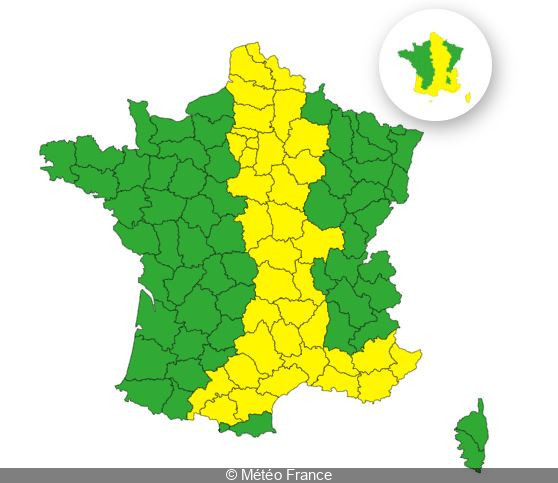
So what can we expect in Paris and the Ile-de-France region? The capital and the entire Ile-de-France region (Hauts-de-Seine, Seine-Saint-Denis, Val-de-Marne, Seine-et-Marne, Yvelines, Essonne and Val-d'Oise) have also been placed on yellow alert for thunderstorms this March 22, 2025.
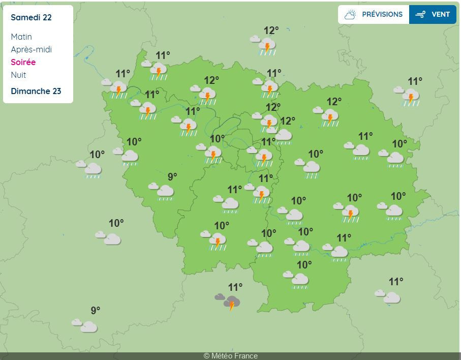
The low-pressure system Martinho " will bring a series of showers along the Atlantic, as well as a rainstorm disturbance in the afternoon, from Normandy to Occitania, passing through Île-de-France, the Centre region, Burgundy and Auvergne ", announces Météo France.
According to the weather service, these thunderstorms could hit the Paris region this Saturday from 4pm. The phenomenon could continue into the evening until 9pm.
As Météo France points out, thunderstorms " can be violent and sudden, with serious consequences ". So how do you protect yourself? On its website, Météo France gives a few tips in the event of thunderstorms:
Official website
meteofrance.com