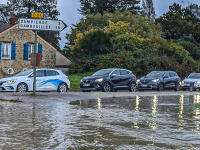
Meteorologists will be keeping a close eye on another day on Wednesday, October 16, 2024 , as the low-pressure system Leslie arrives, bringing with it new disturbances. Météo France is warning of a new risk of thunderstorms in several French departments. In addition to Lozère and Gard, Alpes-Maritimes, Ardèche and Var have been placed under orange vigilance due to the risk of thunderstorms and rain-flooding associated with a Cevenol episode, according to the 6 a.m. bulletin for this Wednesday, October 16. The alert will remain in force until at least midnight.
While all five départements are covered by the rain and flood watch, the storm watch applies to only four of them: Lozère, Gard, Alpes-Maritimes and Var.
Residents and visitors to the region are advised to remain vigilant, follow Météo France's updates and take the necessary precautions to protect themselves from these weather conditions.
In the event of astorm, it's essential to adopt the right reflexes to ensure your safety. Here is a list of the main recommendations to follow to avoid any danger:
Take shelter: at the first sign of a storm, it's best to take shelter in a solid building. If you're in a car, stay inside with the windows closed.
Avoid metal objects: metal objects such as umbrellas, bicycles or fences can attract lightning. Don't touch them, and stay away from them.
Don't take shelter under a tree: although it may seem protective, standing under a tree during a thunderstorm can be extremely dangerous, as lightning often strikes the highest points.
Unplug electrical appliances: to avoid damage from power surges or lightning strikes, we recommend that you unplug electrical appliances and avoid using any connected devices.
Stay away from bodies of water: ponds, lakes, rivers and swimming pools can be particularly dangerous in the event of lightning strikes. Leave any area near water immediately.
Avoid telephoning or handling wired devices: telephone lines and electrical wires can carry lightning. Use cell phones instead, but only in an emergency.
Stay indoors: during a thunderstorm, even if the rain seems light or the storm seems far away, it's best to wait until the storm has passed completely before going outside again.
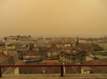
Weather: A cloud of Sahara Sand is forecast for the whole of France
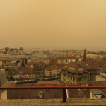
Since the beginning of this week, an unusual meteorological phenomenon has been crossing France: a cloud of sand from the Sahara, carried by winds across the Mediterranean. Already present in the Occitanie region, this cloud will spread to Paris and the whole of the Île-de-France region from Wednesday, October 16, 2024. This veil of dust will affect air quality, while further incursions are expected next week. [Read more]
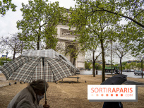
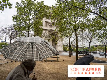
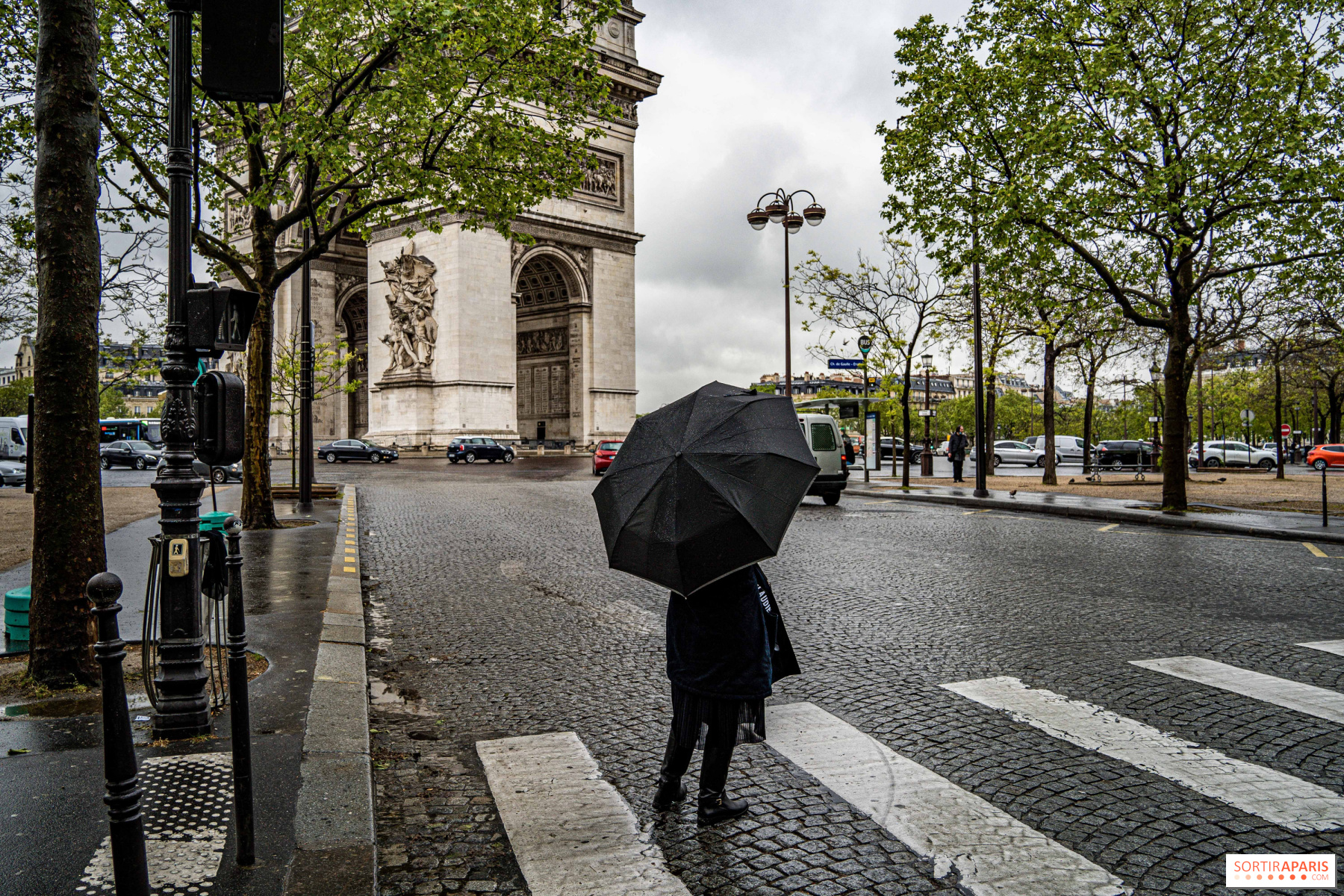
After a short respite and a few sunny days, bad weather returns to the Île-de-France region this October 16, 2024. As ex-hurricane Leslie, transformed into a low-pressure system, continues to make its way across France. Stormy precipitation is expected in the southeast. Is there cause for concern in Ile-de-France? [Read more]


 Weather: A cloud of Sahara Sand is forecast for the whole of France


 Weather: showers back in Paris, should ex-hurricane Leslie be feared in the Ile-de-France region?