The next few hours are likely to be difficult for the country, with the arrival of low-pressure system Irene over a large northern half of France. " France finds itself in the middle of an air mass conflict in the middle of this week. A low-pressure system is moving up from the Bay of Biscay, then crossing the north of the country between Tuesday and Thursday ", explains the Chaîne Météo, which adds that in this zone of air mass conflict, " a major episode of freezing rain begins on Tuesday evening and ends on Wednesday morning".
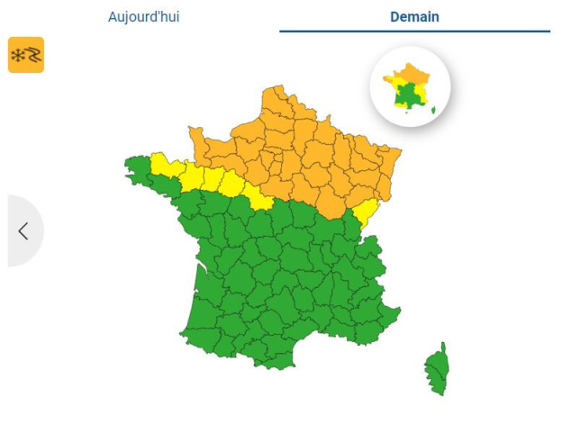
While freezing rain is therefore expected in several French départements due to very cold temperatures, snow could also make a comeback. In today's bulletin, Météo France has placed 18 départements under orange vigilance for the risk of snow and freezing rain. Paris and the whole of the Île-de-France region are affected by this orange alert, which begins this Tuesday, January 16, 2024, at 10 pm.
🔶 18 départements in Orange(https://t.co/CSYEovTI83) pic.twitter.com/PUXOWKErZF
- VigiMétéoFrance (@VigiMeteoFrance) January 16, 2024
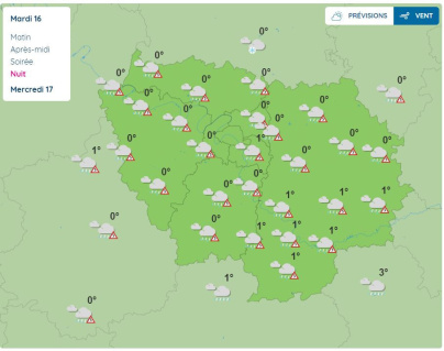
On Tuesday evening, sub-zero temperatures are expected throughout the Paris region, with the mercury dropping to -6°C in the south of Yvelines. On Tuesday night, freezing rain is forecast by Météo France throughout the Île-de-France region, while temperatures could fall to -8°C around Fontainebleau in Seine-et-Marne.
What's next for Wednesday January 17 in Paris and the Île-de-France region? For this new day, Météo France is extending its "snow-verglas" orange vigilance to 16 additional départements. Once again, the entire Paris region is affected by this orange alert for snow and freezing rain, which is set to continue throughout the day. It should be noted that the whole of the Ile-de-France region will also be placed under yellow "rain-flood" vigilance for Wednesday.
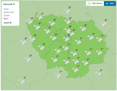
While scattered rain will fall over the Ile-de-France region in the morning and afternoon, with temperatures ranging from 1°C to 3°C in the morning, then from 1°C to 12°C (in the south of Seine-et-Marne) later in the day, snow could fall over a large part of the west and north of the region in the evening. Only the departments of Essonne and Seine-et-Marne should be spared this snowy episode in the evening, due to the positive temperatures forecast.
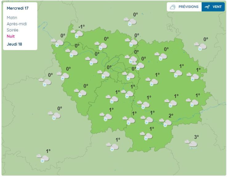
However, on Wednesday night, the snowfall is expected to affect the whole of the Paris region. According to La Chaîne Météo, 1 to 5 cm of snow are expected over the far north, the Normandy coast and the north of the Paris region.
In the morning ofThursday January 18, the Paris region is likely to wake up to a blanket of snow, although clear skies are forecast for the day, except in the south of Seine-et-Marne, where a few flakes could fall again in the morning. In terms of temperatures, the mercury is likely to dip below 0°C in the early hours of the morning, rising to 2°C in the afternoon. In the evening, the cold will return, with temperatures fluctuating between -2°C and -5°C.
Freezing rain and snow in the coming hours in Paris and the Île-de-France region will make roads slippery. Ile-de-France motorists are therefore advised to be extra vigilant. There could also be disruptions to public transport in the Paris region, such as the RER and Transilien networks. Stay tuned to the RATP and SNCF websites for more information.
Weather: when will the cold snap end in Paris and the Île-de-France region?
This winter of 2024 in Paris and the Île-de-France region will have been marked by an episode of snow which, after a few warmer days, was followed by a cold snap in this month of December 2024. But how long will it last? [Read more]
What to do in Paris when it's cold? Ideas for comforting outings in the capital
What to do in Paris when it's cold? Whether you're looking for a hot chocolate, a comforting raclette or a beautiful exhibition, follow the guide! We've got some great ideas to keep you warm! [Read more]
Official website
meteofrance.com


 Weather: when will the cold snap end in Paris and the Île-de-France region?


 What to do in Paris when it's cold? Ideas for comforting outings in the capital


